فراخوان مقاله هشتمین کنفرانس بین المللی اطلاعات مکانی
مشاهده همه همايش های manager
سطح برگزاريبين المللي
محورهاي همايش-------------------
Quantum spatial computingGeoAI, GeoSmartCity, spatial data mining and knowledge discovery and spatial data science
Unmanned Aerial Vehicle (UAV) systems in mapping, mining and geophysical surveys
Spatial big data management
Very high resolution and super-resolution satellite imageries
Geospatial digital twins, virtual reality, augmented reality and immerse technology
Geoscience-aware deep learning methods
Laser scanning for 3D surveying and mapping
SAR image analysis, modeling and techniques, PolSAR and PolInSAR techniques and applications
Target, anomaly and change detection methods
Satellite oceanography
Airborne, terrestrial and mobile mapping
Image and spatial data fusion
Sensor pose estimation, autonomous navigation and spatial intelligence of autonomous driving
Geodetic sensors and 3D measurements and multidimensional spatial modeling
Imaging geodesy and GPS for tectonic and non-tectonic deformation analysis
Modeling atmospheric effects in geodetic observations and climate change modeling
LBS, geospatial services, UBGIS, GSN, location based social networks and sensor web
Indoor, outdoor and seamless positioning and navigation, routing and wayfinding
Cartography, generalization and multi-scale representation
Spatial cognition and spatial linguistics, spatial semantics and spatio-temporal ontologies
Volunteered geospatial/geographic information, crowdsourcing and public participatory GIS
Spatial data structures and algorithms
Cadaster, land administration, SDI, BIM, land use planning, spatial planning and spatially-enabled government
Marine SDI and Integrated coastal zone management
Spatial data quality and uncertainty modeling
Digital terrain modeling
Risk and disaster management
Precision agriculture, land use and land cover mapping and change detection methods
GIScience applications
Geodetic Earth system monitoring
Digital transform and geomatics education
محورهاي همايش
برگزار كنندگان: دانشگاه تهران.
نمایه شده در ISC .
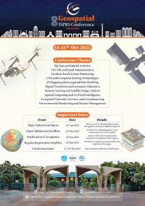
مهلت ارسال چكيده مقالات: اول خرداد 1404
مهلت ارسال متن كامل مقالات:
تاريخ برگزاري همايش: 21 الی 23 مهر 1404
نمایه شده در ISC .
مهلت ارسال چكيده مقالات: اول خرداد 1404
مهلت ارسال متن كامل مقالات:
تاريخ برگزاري همايش: 21 الی 23 مهر 1404
سايت همايش: geospatialconf2025.ut.ac.ir
تلفن تماس دبيرخانه: --
آدرس دبيرخانه:
محل برگزاري: تهران
ایمیل: geospatial.conf@ut.ac.ir
تلفن تماس دبيرخانه: --
آدرس دبيرخانه:
محل برگزاري: تهران
ایمیل: geospatial.conf@ut.ac.ir